I will say that I really don't like being late for races. Especially when it can be really unavoided. I was suppose to meet two other runners at Kowloon Station, and one more at Tsuen Wan West. Two of them bailed at the last moment and Vince would meet me at 8:00AM. I was running just a little late, but once I arrived; Vince was no where to be found. I told him to meet at exit A2.
When I called him and he said, "I'm here". To make a long story short, he was at the wrong station, Tsuen Wan (10 minutes away). This is a guy who has lived in Hong Kong for over 12 years. Enough said about that so now by the time he and the cab driver figured out my location, it was already 8:30AM. Now, finding an English speaking taxi cab outside of Hong Kong Island/Kowloon station is *VERY* difficult. So, we had to hop into and out of many cabs and tell them the place, our Cantonese is terrible and it took another 5 minutes to find a guy who said he knew the place. But, he didn't!

He just wanted to look like he did. Finally, he called someone who knew a little English and then we were heading sorta in the right direction. I saw the map before I left, so I knew the proximity. Luckily, my sense of location prevented us from almost missing the turn which prevented a very terrible race start altogether. We even gave a native Hong Kong runner a free lift to the starting line.

With only 4 minutes left, I registered, placed the race number on my shirt and literally with 3 minutes left, the race began. Unfortunatly, I didn't scan my heartbeat monitor or get a lock on the GPX... So, no map. But, at least I did get the Garmin 405CX start on time for splits and cadence. The moral of the story is don't count on anyone knowing the place without knowing yourself. Doing research before the race can really make the run a lot smoother.
I want to give proper credit that most of the following below is a turn by turn direction of the KOTH STM from their website. I've just modified it to make a little more sense as if I wrote it ;( And all this effort, why event the wheel) and added my own comments with pictures for future runners interested in participating in this race. Do yourself a favor and grab a gpx file from garmin connect. Look at the pictures provided here carefully to prevent the same mistakes that other runners had during this race. I believe there is quite a few DNF who looks like a no show on the race results. I guess they have to mark it up as a training run...
Race Start
 |
| Start of race |
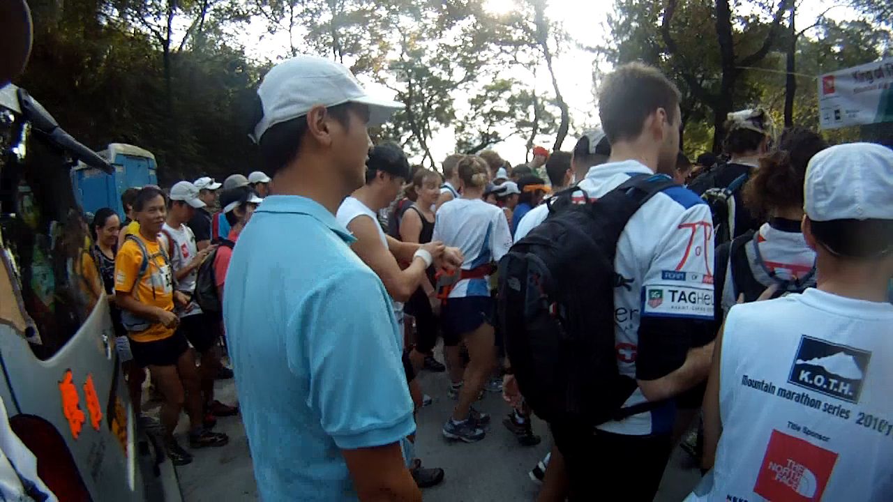 |
| Group of runns waiting for the starting horn |
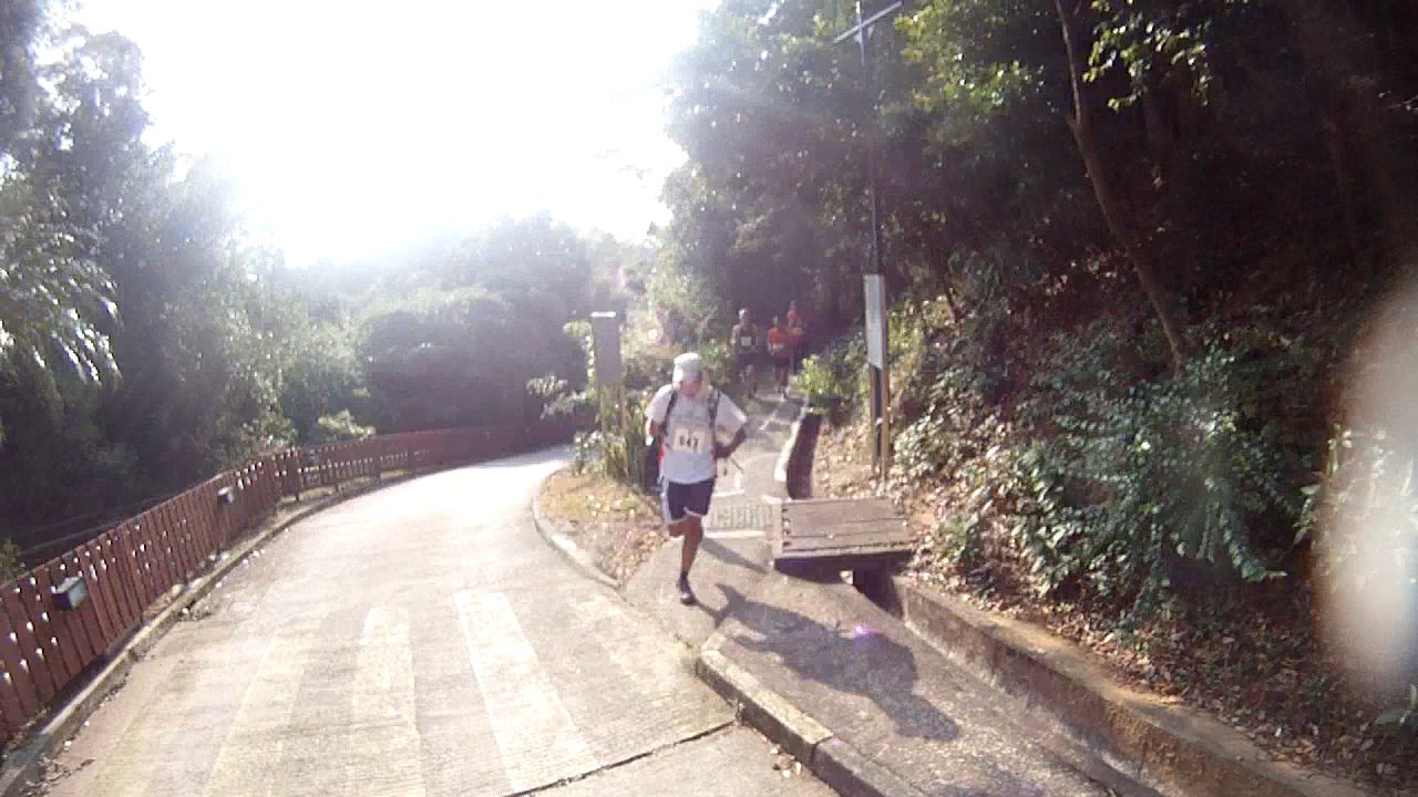
 |
| Low grade incline right off the bat |
I whizzed by the running crowd to notice another trailrunner wearing Vibram Five Fingers. We did the quick brotherhood nod and I moved on. He finished the Half Marathon course. Good show mate!
 |
| Ranger Post |
 |
| Small Bridge |
 |
| Drainage Ditch |
 |
| Tsing Yi and Ma Wan |
For the mortals like me, We had an abrupt change from a run to a hike because of a single narrow lane up some steep stairs overlooking backwards of the Tsing Ma Bridge stretching from Tsing Yi Isle to Ma Wan. I'm sure Michael Maddess from Action Asia Events ran up this with no sweat.
 |
| Dirt Trail |
 |
| Temple with chinese |
 |
| Entering Road |
 |
| Field |
the left.
 |
| Get your walking sticks |
Taking a paved trail to the left at the upper end of the field by a service shack,
 |
| Where the sidewalk ends |
it eventually turns to dirt
 |
| Trails |
and comes to a sign-posted intersection with the pipeline trail. Then we turn right on the pipeline trail and
 |
| Steeplechase |
continue all the way jumping over a low wooden railing
 |
| More tarmac :) |
to a paved road.
 |
| Another trail? Yikes... I thought this was a road race! |
Turning left up the road for several hundred meters, and ignoring the trail off to the right, we met up at a road junction marked by a warden post.
 |
| Stairs and dead leaves |
This keeps on continuing past the post and down some stairs to an intersection of several trails.
 |
| Twist and Turn |
By taking the right-hand trail
 |
| Bam! Boo! |
which soon enters a bamboo grove;
 |
| Undulating trails |
we soon continue along this undulating contour trail for several kilometers.
 |
| Steep descent |
By staying on the main trail and ignore all turns until a stepped descent to Tai Lam Chung Reservoir by Kat Hing Bridge,
we would then turn right when hitting the road
 |
| Step into the road |
 |
| Elderly walkers |
 |
| Aqua Senior |
Water Stop.
 |
| VFF KSO and 2XU Compression Tights |
 On with the race directions, we continue through this intersection on the road toward Ho Pui. After about 1 km on this road,
the route went right down some stairs,

across a bridge

and then left and up the hillside.

Continuing to the intersection above Ho Pui Reservoir and then descending to Ho Pui Reservoir.

Once we crossed the main dam
 and turn immediately left up the mountain biking trail, we would gain another contour trail. I had a splash on the trail, most likely stubbling over a tree root. The fall seemed coordinated as I didn't scrape any skin. It could be the fact that I have been falling a lot and I don't have any more skin. Once I got up, I finally trekked left and continue for several kilometers to a marked turn to the right that climbs consistently to intersect with the Maclehose.
  At the first water stop, there was no need to stop since I only drank half of the water in my camel back.
Then the descent took us directly down the other side to a clearing.

The arrows pointed us to turn left down a short hill and then bear right on the trail down to Chuen Long.


 |
| This is definately not part of the course! |
Once we found our bearings, we continue up a concrete path past the village homes and after a couple of twists and turns, bear left steeply up a dirt path. Being heavily marked, I continued up this path across one road and turn right along the road at the second crossing.
At the first bend in the road, I followed the arrows pointing left through a gap in the vegetation and then turn steeply left up hill.

The next climb would require bush wacking as we went up hill on the overgrown weed-fest, ignoring the major trail that breaks off to the right. I managed to get a lot of thorns and scratches in this area. So, gloves would be recommended for the next vegetation run.


passing the Tai Mo Shan Fire Lookout

and bear left slightly down hill to a major trail intersection,

the water stop was near.


This part of the path was quite difficult for me because the vegetation was high and the rocks (sharp and little) were all over the place. I had several occurences of stubbing my pinky toe. As I followed the less defined trail diagonally off to the right across a very small stream, it continued along this undulating trail down to another stream and then pay particular attention to the correct route through a series of alpine meadows. Each time the trail appears to split, the correct route was to the left.
Eventually the climb proved to be a worthwhile sight of a prominent rock formation. The view was amazing. Once I begin to descend steeply down the southern flank of Tai Mo Shan, I slipped a few times.
 The Five Fingers KSO doesn't have enough grip for dry loose dirt, so I tried to be very careful of not slipping which slowed my travel time immensely. (note, if you see my arm in a picture; it's not a good sign). By the way this image has been rotated 90 degrees.

 |
| We're so lost. This guy orange shirt surely DNF (Did Not Finish) |

 |
| If you see this garage/dog, you are no longer participating in the race. |
With another runner's help we went left down a road which curved around to the right.


(Where's the rest of the pictures - battery ran out!)
This continued down the trail past a village on the left and eventually along a yellow railing to Route Twisk. Again, crossing the road carefully, we would find our water stop. After the break, I joined up with the catchwater trail heading west. After a couple of kilometers, ignoring the first couple of trails off to the right, we eventually turn right along a stream and then left steeply up hill toward Ha Fa Shan. This would join a major trail with great views of the airport and pass below and to the left of Shek Lung Kung mountain which is recognizable by the radio antennas on its summit. We continue down a partially paved path to a grassy area with a signpost to Sheung Tong to the right and straight ahead to Tsing Fai Tong. Straight ahead on the pipeline trail toward Tsing Fai Tong, it finally rejoined the half marathon course. After cresting a couple of hills, I blindly look for a not-obvious left turn (marked with ribbons) onto an overgrown trail by luck. Then continued through the shiggy for about 30 meters and coming out on a main trail. Turning left, I followed this trail around a hill and down to the base of a very steep hill directly in front. I then turned right just beyond a large, fallen tree down to Tsing Fai Tong.
As I continued along the edge of the field to the small row of houses, I reached another water stop. . Actually by this point, the volunteer at the water stop was clapping A LOT (It was a nice gesture).. I thought it can't be far. It was only 5km away.
I continued bearing left around the edge of the field out of the village, past a thicket of bamboo and up a slight rise to another trail signpost. But, then followed a paved road leading downward. I realized after 2km that I took the wrong turn, then decided to walk back up to where I started. Finally, I found the correct turn which led to the pipeline trail and shortly afterward turn left along the hiking trail (Marked by a danger steep cliffs sign). This trail was the most difficult because the cement wasn't smooth and exposed a lot of sharp rocks making up the broken concrete. It prevent me from running and I had to carefully cross slowly. This trail went on for a couple of kilometers to another sign-posted intersection. With a turn sharply left, I continued up the stairs to a height of land. This continued down the other side on the main trail. Soon, I could hear voice from afar as I descended all the way to Sham Tseng Reservoir, crossing a small bridge and climb the stairs on the other side to the road. Finally the last turn right with 100 meters left to the finish.
I gulped down 2 beers and walked down to Castle Peak Road with Vince who waited over 2 hours for me. Everything from the drive in this morning was forgotten! After a rough race, it's nice to have someone that is willing to wait around.

I have more pictures of this race with lots of individual photos of the runners that day. If you see somebody you know, make sure you tag them. They could win a free pair of VFF's
Congrats. That was a tough race. I was the dude that said hi (with fist bump) coming down the mountain.
ReplyDeleteYou are brave for doing that race in VFFs.
i would not attempt the Lantau one in VFFs!!
ReplyDelete